Australian avocado, mango and macadamia crops studied by high tech satellites.
Originally posted ABC Rural By Kallee Buchanan
In a small lecture theatre at the CQUniversity campus in Bundaberg, Dr James Underwood is giving a presentation about his work capturing images of mango, macadamia and avocado trees.
The researcher from the Australian Centre for Field Robotics mounted a robot called Shrimp with a range of sensors that capture 2D and 3D images, photographs, thermal readings and hyperspectral scans and sent it up the orchard rows at Simpson Farms, near Bundaberg.
The images it produced are both familiar-looking and somewhat alien; from colour photos that look like they were taken at night, to wavy streams of colour that are loosely tree-shaped and bright orange 3D projections of trees made using reflective light, or LiDAR, to show every branch.
During the presentation, Dr Underwood shows a thermal image of an avocado tree – a ghostly light-grey trunk stands out against a slightly darker background.
The audience of researchers, farmers, extension officers and agronomists take note of the dark patch at the bottom of the trunk, showing an area cooler than the rest of the tree.
Dr Underwood does not know – he is the robotics guy – perhaps an agronomist has a better idea?
Suncoast Gold Macadamia extension officer Chris Searle chimes in, suggesting some conditions would make the trunk appear hotter.
There are questions over whether the difference between natural variations in temperature (such as water availability) and pathogens could be determined?

While the conversation bounces around the room, Dr Underwood takes notes. He wants to know what images the growers are most interested in to target the next phase of his research.
He is working as part of the National Tree Project, a $7 million multi-group study funded by the Federal Government’s Rural Research and Development for Profit program and Horticulture Innovation Australia.
The idea is to give growers an unprecedented understanding of the variability of productivity and quality within their orchards, helping them make better decisions about inputs like irrigation and fertiliser.
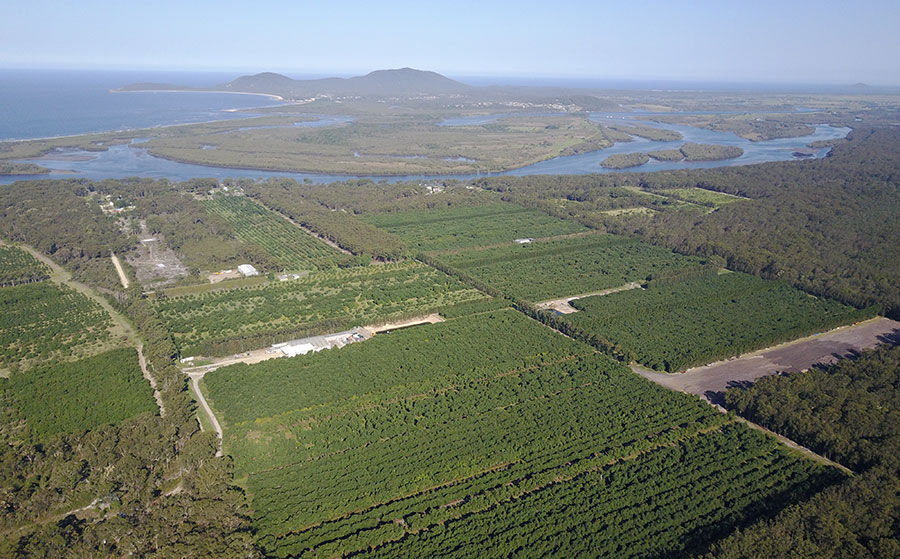
Every crop over two hectares will be photographed from the sky, amounting to about 90,000 hectares nationwide.
The photos will then be analysed and converted into data on tree vigour, yield, pest detection and surveillance, crop forecasts and productivity.
The project is being led by University of New England associate professor Andrew Robson, an agricultural remote sensing scientist.
Professor Robson said in the past two years satellites were used to measure average fruit weight in avocados, paving the way for the larger national mapping project.
“In terms of agriculture this sort of work’s been around for nearly 30 years now, so there’s been a lot of crop mapping for high growth areas and low growth areas, which allow agronomists or growers to work out what’s driving poor productivity or high productivity,” Professor Robson said.
“It’s definitely increased with the applications with technology.
“Obviously the advent of drones everywhere, we have really high resolution satellites available commercially at a cost effective price so these applications are not just high growth and low growth, it’s actually looking at specific diseases and specific parameters of yield or quality.”

Dr Robson has done similar work with banana crops, where researchers were trying to identify critical conditions like Panama Tropical Race 4 using satellite imagery.
The devastating disease found in Tully, in North Queensland, in 2015 has the potential to wipe out Australia’s Cavendish crop, but so far has been contained to one farm.
Biosecurity Queensland has expanded surveillance for the pathogen to nearby Lakeland, but the work carries its own risks, with the potential for well-meaning officers accidentally spreading the disease through their surveillance activities.
Panama disease first presents with a yellowing of the leaves that later dry and burn out, leaving researchers to wonder if it could be spotted not just from the ground, but from above.
But there is a lot of work to be done before that question can be answered, as yellowing leaves can also be a sign of nutritional problems or water stress, and bananas can be difficult to spot using satellites as they tend to be below rainforest canopies.
Dr Robson said despite the challenges, the technique had the potential to offer a new layer of protection for horticulture against biosecurity threats.
“In the event of an outbreak of diseases, or post disaster, they can access these (maps) and know where all the crops are and how to manage things like outbreaks,” he said.
“Things like yield forecasting, identifying disease spread, poor and high nutrition across crops, quality, fruit weight, all that helps with management, harvest segregation, disease control, nutrition management, so things like that.”
The method could also be used to map disasters like floods, fires and cyclones and speed up applications for recovery assistance.
It was not lost on Dr Robson that his group was meeting in Bundaberg, the scene of utter devastation from the region’s worst ever floods just three years ago.
“(If) we had information on how many trees and where they were pre-flood and then again afterwards, we could definitely work out what was lost and obviously tie that in to productivity information and estimated value of lost productivity for those growers,” he said.

The project has generated great interest in academic circles.
Four universities are participating, along with industry groups such as the Australian Macadamia Society, the Australian Mango Industry Association and Avocados Australia.
It has also had input from Bundaberg’s Simpson Farms, where many of the trials have been run, and the Queensland Department of Agriculture and Fisheries, and technology consultants AgTrix.
Horticulture Innovation Australia research and development lead Anthony Kachenko said the work represented the growing role of science and innovation in agriculture.
“This is a key example of how industry is looking at innovative blue sky research opportunities to enhance productivity on farm,” Mr Kachenko said.
“This project is expected to deliver tools to enhance farm-level decision using satellite image data, novel on-ground sensors and agricultural robotics.
“The need to look at high-tech opportunities is critical for industry to compete in both the domestic and export arenas.”

He said while it was very high-tech, the collaborative project had been embraced by growers keen to see how technology could improve productivity in fiercely competitive markets.
At the forefront of much of the research is the macadamia industry, which sees 70 per cent of its crop exported.
Chief executive officer of the Australian Macadamia Society Jolyn Burnett said the industry has long had one of the highest research and development levies as a percentage of farm gate value in the country.
“We have to be globally competitive, especially with low labour cost producers like South Africa and Kenya,” Mr Burnett said.
“The industry is highly mechanised and has invested heavily in biological control and advanced orchard management.
“This means we can compete with countries where labour is a tenth the cost of Australia.”
But he said labour rates were rising in developing countries too and they had the potential to catch up technologically, particularly in countries like China and Vietnam.
So the industry needed to reduce costs and lift productivity, and the National Tree Project might help.
One of the key issues researchers are trying to overcome is accuracy of crop projections, which have the potential to spook markets if they are wrong.
One researcher said he had four people count the avocados on one tree.
They came back with a variance among them of up to 50 fruit on a tree with about 250 fruit – a huge margin of error when multiplied out across thousands of trees.

Mr Burnett, of the macadamia society, said a more scientific, reliable method of providing crop projections was critical for price stability and market confidence.
“The market hates surprises,” he said.
“Macadamias represent just one per cent of the world trade in tree nuts, so we are very susceptible to fluctuations in supply and subsequently price.
“It is essential that we give the market credible and accurate forecasts, not just for the coming crop, but for years ahead.
“This allows us to anticipate demand and develop new markets to ensure that supply and demand are as closely aligned as possible.”
The macadamia industry is young, with just 40 years of research to inform its production.
Mr Burnett said if the collaborative project with the mango and avocado industry was a success, it would be a major achievement for all three industries.
“We have many challenges in common,” he said.
“Large evergreen dense trees create a number of challenges in terms of maximising yield per hectare, spray coverage, managing tree vigour, canopy management, orchard floor management, etcetera.
“Growers are very good, probably better than researchers, at seeing the synergies from other crops and applying them to their own situation, however they must be able to see the direct relevance for their crop.”
In 2016 the project will move into phase two which will see the footprint maps of each industry refined to provide the most bang for the expensive satellite’s buck.
Researchers will also drill down to orchard level detail, and in some cases map and measure individual trees.
Associate Professor Andrew Robson said the scale of the project would help make using the data affordable for farmers.
“(For) more and more of these intensive growing regions that have a lot going on like sugar cane and horticulture, cross industry investment from the industry groups will mean that those outputs at the end would be a lot cheaper,” he said.
“And definitely as I mentioned before, the technologies are getting cheaper and cheaper.”
The final results are expected in 2018.
